BNG - British National Grid
Intro
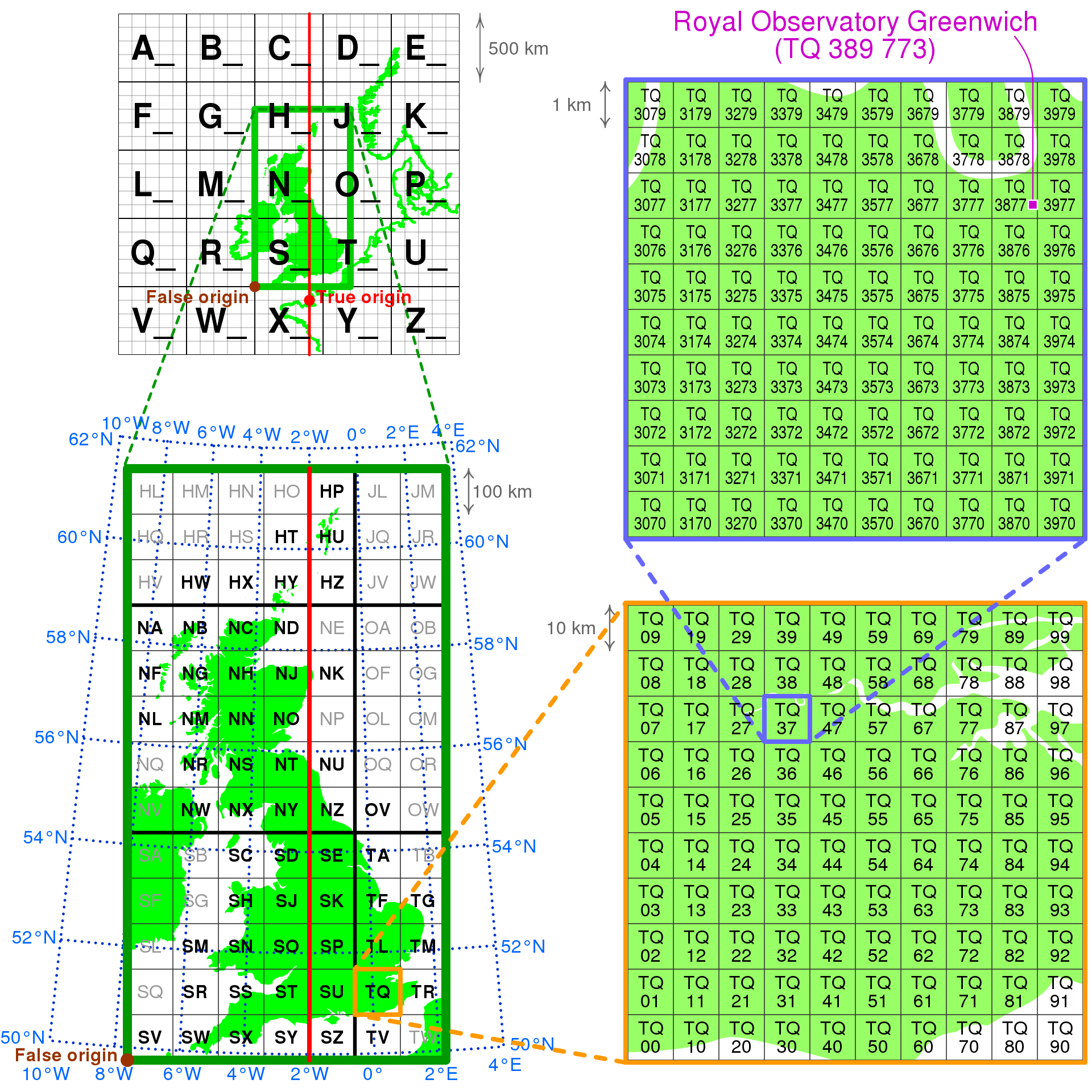
The Ordnance Survey National Grid reference system also known as the British National Grid (BNG) is a grid index system defined over the territory of Great Britain and is extensively being used by many organizations in UK for indexing their geospatial data. Mosaic supports multiple different grid indexes. One of the supported index systems is the British National Grid. All of the operations that can be performed on H3 grid system are transferable to BNG grid system, and in general, are transferable to a generic index system.
Configuring BNG
The default index system for Mosaic is H3. If the users wish to use BNG instead, this can be achieved using spark configurations. Spark provides an easy way to supply configuration parameters using spark.conf.set API.
import mosaic as mos

spark.conf.set("spark.databricks.labs.mosaic.index.system", "BNG")
mos.enable_mosaic(spark, dbutils)
import com.databricks.labs.mosaic.functions.MosaicContext
import com.databricks.labs.mosaic.{BNG, JTS}

val mosaicContext = MosaicContext.build(BNG, JTS)
import mosaicContext.functions._
library(sparkrMosaic)
enableMosaic("JTS", "BNG")
-- For SQL please use Automatic SQL Configuration. See: https://databrickslabs.github.io/mosaic/usage/automatic-sql-registration.html
-- Otherwise, use python configuration in the first cell of your notebook, then use SQL in the rest of the notebook.
Coordinate Reference System
British National Grid (BNG) expects that coordinates are provided in EPSG:27700 coordinate reference system. EPSG:27700 CRS is also referred to as “OSGB36 / British National Grid – United Kingdom Ordnance Survey”. For more information on the CRS you can visit EPSG:27700.
If your data in is not provided in EPSG:27700 we would recommend to either switch the indexing strategy to H3 or to reproject the data from source CRS to EPSG:27700. Mosaic provides the functionality to set CRS ID even for geometries that arrive as WKT and WKB (the formats do not capture the CRS information and this information has to be set manually).
### CRS codes assume EPSG
df = df.withColumn("geometry", mos.st_setsrid("geometry", 4326))
df = df.withColumn("geometry", mos.st_transform("geometry", 27700))
### CRS codes assume EPSG
val withSrcCRS = df.withColumn("geometry", mos.st_setsrid("geometry", 4326))
val withReprojected = withSrcCRS.withColumn("geometry", mos.st_transform("geometry", 27700))
### CRS codes assume EPSG
df <- withColumn(df, "geometry", mos.st_setsrid(df$geometry, 4326))
df <- withColumn(df, "geometry", mos.st_transform(df$geometry, 27700))
Mosaic provides functionality to verify provided geometries have all of their vertices within bounds of the specified CRS. If the CRS isn’t EPSG:4326 then the functionality allows to prefer checks on the coordinates before and/or after reprojection. This allows the end users to filter out geometries that would not be possible to index with BNG.
df = df.withColumn("is_within_bng_bounds", st_hasvalidcoordinates(geometry, 'EPSG:27700', 'reprojected_bounds'))
val withValidCoords = df.withColumn("is_within_bng_bounds", st_hasvalidcoordinates(geometry, 'EPSG:27700', 'reprojected_bounds'))
df <- withColumn(df, "is_within_bng_bounds", st_hasvalidcoordinates(geometry, 'EPSG:27700', 'reprojected_bounds'))
SELECT *, st_hasvalidcoordinates(geometry, 'EPSG:27700', 'reprojected_bounds') as is_within_bng_bounds
Mosaic supports all indexing operations for both H3 and BNG. Please see Spatial Indexing for supported indexing operations.