Rasterio UDFs
Intro
Rasterio (https://rasterio.readthedocs.io/en/latest/) is a Python library for reading and writing geospatial raster datasets. It uses GDAL (https://gdal.org/) for file I/O and raster formatting and provides a Python API for GDAL functions. It is a great library for working with raster data in Python and it is a popular choice for many geospatial data scientists. Rasterio UDFs provide a way to use Rasterio Python API in Spark for distributed processing of raster data. The data structures used by Mosaic are compatible with Rasterio and can be used interchangeably. In this section we will show how to use Rasterio UDFs to process raster data in Mosaic + Spark. We assume that you have a basic understanding of Rasterio and GDAL.
Please note that we advise the users to set these configuration to ensure proper distribution.
spark.conf.set("spark.sql.execution.arrow.enabled", "true")
spark.conf.set("spark.sql.execution.arrow.maxRecordsPerBatch", "1024")
spark.conf.set("spark.sql.execution.arrow.fallback.enabled", "true")
spark.conf.set("spark.sql.adaptive.coalescePartitions.enabled", "false")
spark.conf.set("spark.sql.shuffle.partitions", "400")
Rasterio raster plotting
In this example we will show how to plot a raster file using Rasterio Python API.
Firstly we will create a spark DataFrame from a directory of raster files.
df = spark.read.format("gdal").load("dbfs:/path/to/raster/files").repartition(400)
df.show()
+-----------------------------------------------------------+------------------------------+-----------+---------------------+-------+-------+-----------+----------------------+-------------+-------+---------------------------------------------------------------------------------------------------------------+
|                                                      path |             modificationTime |    length |                uuid | ySize | xSize | bandCount |             metadata | subdatasets |  srid |                                                                                                          tile |
+-----------------------------------------------------------+------------------------------+-----------+---------------------+-------+-------+-----------+----------------------+-------------+-------+---------------------------------------------------------------------------------------------------------------+
| dbfs:/FileStore/geospatial/odin/alaska/B02/-424495268.tif | 1970-01-20T15:49:53.135+0000 | 211660514 | 7836235824828840960 | 10980 | 10980 |         1 | {AREA_OR_POINT=Po... |          {} | 32602 | {index_id: 593308294097928191, raster: [00 01 10 ... 00], parentPath: "dbfs:/path_to_file", driver: "GTiff" } |
| dbfs:/FileStore/geospatial/odin/alaska/B02/-524425268.tif | 1970-01-20T15:49:53.135+0000 | 212060218 | 7836235824828840961 | 10980 | 10980 |         1 | {AREA_OR_POINT=Po... |          {} | 32602 | {index_id: 593308294097927192, raster: [00 01 10 ... 00], parentPath: "dbfs:/path_to_file", driver: "GTiff" } |
| dbfs:/FileStore/geospatial/odin/alaska/B02/1241323268.tif | 1970-01-20T15:49:53.135+0000 | 211660897 | 7836235824828840962 | 10980 | 10980 |         1 | {AREA_OR_POINT=Po... |          {} | 32602 | {index_id: 593308294097929991, raster: [00 01 10 ... 00], parentPath: "dbfs:/path_to_file", driver: "GTiff" } |
| ...                                                       | ...                          | ...       | ...                 | ...   | ...   | ...       | ...                  | ...         | ...   | ...                                                                                                           |
+-----------------------------------------------------------+------------------------------+-----------+---------------------+-------+-------+-----------+----------------------+-------------+-------+---------------------------------------------------------------------------------------------------------------+
Next we will define a function that will plot a given raster file.
import numpy as np
import rasterio
from rasterio.io import MemoryFile
from io import BytesIO
from pyspark.sql.functions import udf

def plot_raster(raster):
    fig, ax = pyplot.subplots(1, figsize=(12, 12))

    with MemoryFile(BytesIO(raster)) as memfile:
        with memfile.open() as src:
            show(src, ax=ax)
            pyplot.show()
Finally we will apply the function to the DataFrame collected results. Note that in order to plot the raster we need to collect the results to the driver. Please apply reasonable filters to the DataFrame before collecting the results.
plot_raster(df.select("tile").limit(1).collect()[0]["tile"]["raster"])
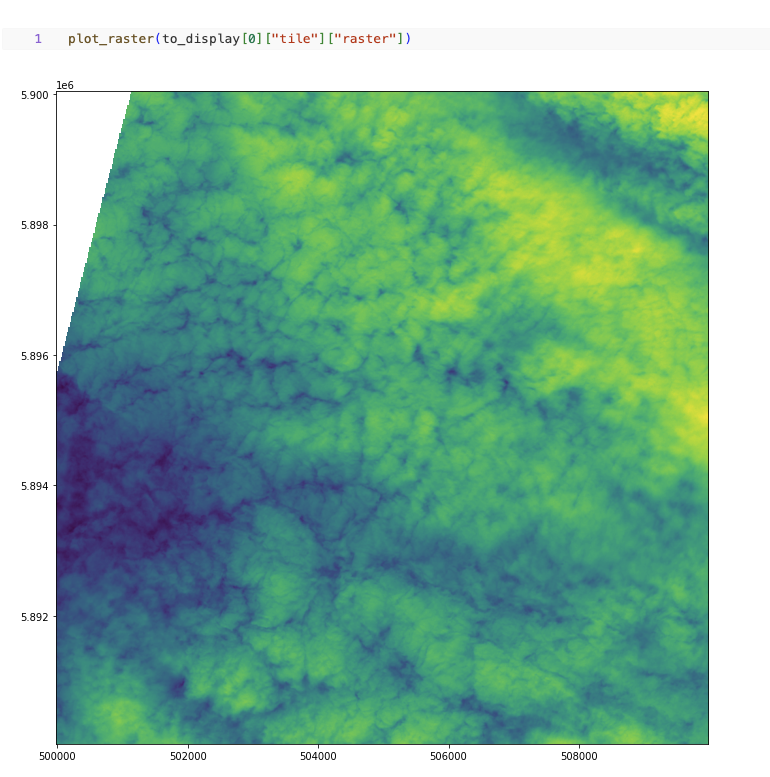
Fig 1. Plot raster using Rasterio Python API
UDF example for computing band statistics
In this example we will show how to compute band statistics for a raster file.
Firstly we will create a spark DataFrame from a directory of raster files.
df = spark.read.format("gdal").load("dbfs:/path/to/raster/files").repartition(400)
df.show()
+-----------------------------------------------------------+------------------------------+-----------+---------------------+-------+-------+-----------+----------------------+-------------+-------+---------------------------------------------------------------------------------------------------------------+
|                                                      path |             modificationTime |    length |                uuid | ySize | xSize | bandCount |             metadata | subdatasets |  srid |                                                                                                          tile |
+-----------------------------------------------------------+------------------------------+-----------+---------------------+-------+-------+-----------+----------------------+-------------+-------+---------------------------------------------------------------------------------------------------------------+
| dbfs:/FileStore/geospatial/odin/alaska/B02/-424495268.tif | 1970-01-20T15:49:53.135+0000 | 211660514 | 7836235824828840960 | 10980 | 10980 |         1 | {AREA_OR_POINT=Po... |          {} | 32602 | {index_id: 593308294097928191, raster: [00 01 10 ... 00], parentPath: "dbfs:/path_to_file", driver: "GTiff" } |
| dbfs:/FileStore/geospatial/odin/alaska/B02/-524425268.tif | 1970-01-20T15:49:53.135+0000 | 212060218 | 7836235824828840961 | 10980 | 10980 |         1 | {AREA_OR_POINT=Po... |          {} | 32602 | {index_id: 593308294097927192, raster: [00 01 10 ... 00], parentPath: "dbfs:/path_to_file", driver: "GTiff" } |
| dbfs:/FileStore/geospatial/odin/alaska/B02/1241323268.tif | 1970-01-20T15:49:53.135+0000 | 211660897 | 7836235824828840962 | 10980 | 10980 |         1 | {AREA_OR_POINT=Po... |          {} | 32602 | {index_id: 593308294097929991, raster: [00 01 10 ... 00], parentPath: "dbfs:/path_to_file", driver: "GTiff" } |
| ...                                                       | ...                          | ...       | ...                 | ...   | ...   | ...       | ...                  | ...         | ...   | ...                                                                                                           |
+-----------------------------------------------------------+------------------------------+-----------+---------------------+-------+-------+-----------+----------------------+-------------+-------+---------------------------------------------------------------------------------------------------------------+
Next we will define a function that will compute band statistics for a given raster file.
import numpy as np
import rasterio
from rasterio.io import MemoryFile
from io import BytesIO
from pyspark.sql.functions import udf

@udf("double")
def compute_band_mean(raster):
  with MemoryFile(BytesIO(raster)) as memfile:
    with memfile.open() as dataset:
      return dataset.statistics(bidx = 1).mean
Finally we will apply the function to the DataFrame.
df.select(compute_band_mean("tile.raster")).show()
+----------------------------+
| compute_band_mean(raster)  |
+----------------------------+
|         0.0111000000000000 |
|         0.0021000000000000 |
|         0.3001000000000000 |
| ...                        |
+----------------------------+
UDF example for computing NDVI
In this example we will show how to compute NDVI for a raster file. NDVI is a common index used to assess vegetation health. It is computed as follows: ndvi = (nir - red) / (nir + red). NDVI output is a single band raster file with values in the range [-1, 1]. We will show how to return a raster object as a result of a UDF.
Firstly we will create a spark DataFrame from a directory of raster files.
df = spark.read.format("gdal").load("dbfs:/path/to/raster/files").repartition(400)
df.show()
+-----------------------------------------------------------+------------------------------+-----------+---------------------+-------+-------+-----------+----------------------+-------------+-------+---------------------------------------------------------------------------------------------------------------+
|                                                      path |             modificationTime |    length |                uuid | ySize | xSize | bandCount |             metadata | subdatasets |  srid |                                                                                                          tile |
+-----------------------------------------------------------+------------------------------+-----------+---------------------+-------+-------+-----------+----------------------+-------------+-------+---------------------------------------------------------------------------------------------------------------+
| dbfs:/FileStore/geospatial/odin/alaska/B02/-424495268.tif | 1970-01-20T15:49:53.135+0000 | 211660514 | 7836235824828840960 | 10980 | 10980 |         1 | {AREA_OR_POINT=Po... |          {} | 32602 | {index_id: 593308294097928191, raster: [00 01 10 ... 00], parentPath: "dbfs:/path_to_file", driver: "GTiff" } |
| dbfs:/FileStore/geospatial/odin/alaska/B02/-524425268.tif | 1970-01-20T15:49:53.135+0000 | 212060218 | 7836235824828840961 | 10980 | 10980 |         1 | {AREA_OR_POINT=Po... |          {} | 32602 | {index_id: 593308294097927192, raster: [00 01 10 ... 00], parentPath: "dbfs:/path_to_file", driver: "GTiff" } |
| dbfs:/FileStore/geospatial/odin/alaska/B02/1241323268.tif | 1970-01-20T15:49:53.135+0000 | 211660897 | 7836235824828840962 | 10980 | 10980 |         1 | {AREA_OR_POINT=Po... |          {} | 32602 | {index_id: 593308294097929991, raster: [00 01 10 ... 00], parentPath: "dbfs:/path_to_file", driver: "GTiff" } |
| ...                                                       | ...                          | ...       | ...                 | ...   | ...   | ...       | ...                  | ...         | ...   | ...                                                                                                           |
+-----------------------------------------------------------+------------------------------+-----------+---------------------+-------+-------+-----------+----------------------+-------------+-------+---------------------------------------------------------------------------------------------------------------+
Next we will define a function that will compute NDVI for a given raster file.
import numpy as np
import rasterio
from rasterio.io import MemoryFile
from io import BytesIO
from pyspark.sql.functions import udf

@udf("binary")
def compute_ndvi(raster, nir_band, red_band):
  with MemoryFile(BytesIO(raster)) as memfile:
    with memfile.open() as dataset:
      red = dataset.read(red_band)
      nir = dataset.read(nir_band)
      ndvi = (nir - red) / (nir + red)
      profile = dataset.profile
      profile.update(count = 1, dtype = rasterio.float32)
      # Write the NDVI to a tmp file and return it as binary
      # This is a workaround an issue occurring when using
      # MemoryFile for writing using an updated profile
      with tempfile.NamedTemporaryFile() as tmp:
        with rasterio.open(tmp.name, "w", **profile) as dst:
          dst.write(ndvi.astype(rasterio.float32))
        with open(tmp.name, "rb") as f:
          return f.read()
Finally we will apply the function to the DataFrame.
df.select(compute_ndvi("tile.raster", lit(1), lit(2))).show()
# The output is a binary column containing the NDVI raster
+------------------------------+
| compute_ndvi(raster, 1, 2)   |
+------------------------------+
| 000000 ... 00000000000000000 |
| 000000 ... 00000000000000000 |
| 000000 ... 00000000000000000 |
| ...                          |
+------------------------------+

# We can update the tile column with the NDVI raster in place as well
# This will overwrite the existing raster field in the tile column
df.select(col("tile").withField("raster", compute_ndvi("tile.raster", lit(1), lit(2)))).show()
+-----------------------------------------------------------+------------------------------+-----------+---------------------+-------+-------+-----------+----------------------+-------------+-------+---------------------------------------------------------------------------------------------------------------+
|                                                      path |             modificationTime |    length |                uuid | ySize | xSize | bandCount |             metadata | subdatasets |  srid |                                                                                                          tile |
+-----------------------------------------------------------+------------------------------+-----------+---------------------+-------+-------+-----------+----------------------+-------------+-------+---------------------------------------------------------------------------------------------------------------+
| dbfs:/FileStore/geospatial/odin/alaska/B02/-424495268.tif | 1970-01-20T15:49:53.135+0000 | 211660514 | 7836235824828840960 | 10980 | 10980 |         1 | {AREA_OR_POINT=Po... |          {} | 32602 | {index_id: 593308294097928191, raster: [00 01 10 ... 00], parentPath: "dbfs:/path_to_file", driver: "GTiff" } |
| dbfs:/FileStore/geospatial/odin/alaska/B02/-524425268.tif | 1970-01-20T15:49:53.135+0000 | 212060218 | 7836235824828840961 | 10980 | 10980 |         1 | {AREA_OR_POINT=Po... |          {} | 32602 | {index_id: 593308294097927192, raster: [00 01 10 ... 00], parentPath: "dbfs:/path_to_file", driver: "GTiff" } |
| dbfs:/FileStore/geospatial/odin/alaska/B02/1241323268.tif | 1970-01-20T15:49:53.135+0000 | 211660897 | 7836235824828840962 | 10980 | 10980 |         1 | {AREA_OR_POINT=Po... |          {} | 32602 | {index_id: 593308294097929991, raster: [00 01 10 ... 00], parentPath: "dbfs:/path_to_file", driver: "GTiff" } |
| ...                                                       | ...                          | ...       | ...                 | ...   | ...   | ...       | ...                  | ...         | ...   | ...                                                                                                           |
+-----------------------------------------------------------+------------------------------+-----------+---------------------+-------+-------+-----------+----------------------+-------------+-------+---------------------------------------------------------------------------------------------------------------+
UDF example for writing raster files to disk
In this example we will show how to write a raster file to disk using Rasterio Python API. This is an examples showing how to materialize a raster binary object as a raster file on disk. The format of the output file should match the driver format of the binary object.
Firstly we will create a spark DataFrame from a directory of raster files.
df = spark.read.format("gdal").load("dbfs:/path/to/raster/files").repartition(400)
df.show()
+-----------------------------------------------------------+------------------------------+-----------+---------------------+-------+-------+-----------+----------------------+-------------+-------+---------------------------------------------------------------------------------------------------------------+
|                                                      path |             modificationTime |    length |                uuid | ySize | xSize | bandCount |             metadata | subdatasets |  srid |                                                                                                          tile |
+-----------------------------------------------------------+------------------------------+-----------+---------------------+-------+-------+-----------+----------------------+-------------+-------+---------------------------------------------------------------------------------------------------------------+
| dbfs:/FileStore/geospatial/odin/alaska/B02/-424495268.tif | 1970-01-20T15:49:53.135+0000 | 211660514 | 7836235824828840960 | 10980 | 10980 |         1 | {AREA_OR_POINT=Po... |          {} | 32602 | {index_id: 593308294097928191, raster: [00 01 10 ... 00], parentPath: "dbfs:/path_to_file", driver: "GTiff" } |
| dbfs:/FileStore/geospatial/odin/alaska/B02/-524425268.tif | 1970-01-20T15:49:53.135+0000 | 212060218 | 7836235824828840961 | 10980 | 10980 |         1 | {AREA_OR_POINT=Po... |          {} | 32602 | {index_id: 593308294097927192, raster: [00 01 10 ... 00], parentPath: "dbfs:/path_to_file", driver: "GTiff" } |
| dbfs:/FileStore/geospatial/odin/alaska/B02/1241323268.tif | 1970-01-20T15:49:53.135+0000 | 211660897 | 7836235824828840962 | 10980 | 10980 |         1 | {AREA_OR_POINT=Po... |          {} | 32602 | {index_id: 593308294097929991, raster: [00 01 10 ... 00], parentPath: "dbfs:/path_to_file", driver: "GTiff" } |
| ...                                                       | ...                          | ...       | ...                 | ...   | ...   | ...       | ...                  | ...         | ...   | ...                                                                                                           |
+-----------------------------------------------------------+------------------------------+-----------+---------------------+-------+-------+-----------+----------------------+-------------+-------+---------------------------------------------------------------------------------------------------------------+
Next we will define a function that will write a given raster file to disk. A “gotcha” to keep in mind is that you do not want to have a file context manager open when you go to write out its context as the context manager will not yet have been flushed. Another “gotcha” might be that the raster dataset does not have CRS included; if this arises, we recommend adjusting the function to specify the CRS and set it on the dst variable, more at rasterio.crs. We would also point out that notional “file_id” param can be constructed as a repeatable name from other field(s) in your dataframe / table or be random, depending on your needs.
@udf("string")
def write_raster(raster, driver, file_id, fuse_dir):
    from io import BytesIO
    from pathlib import Path
    from pyspark.sql.functions import udf
    from rasterio.io import MemoryFile
    import numpy as np
    import rasterio
    import shutil
    import tempfile

    # - [1] populate the initial profile
    # # profile is needed in order to georeference the image
    with tempfile.TemporaryDirectory() as tmp_dir:
        profile = None
        data_arr = None
        with MemoryFile(BytesIO(raster)) as memfile:
            with memfile.open() as dataset:
                profile = dataset.profile
                data_arr = dataset.read()
        # here you can update profile using .update method
        # example https://rasterio.readthedocs.io/en/latest/topics/writing.html
        # - [2] get the correct extension
        extensions_map = rasterio.drivers.raster_driver_extensions()
        driver_map = {v: k for k, v in extensions_map.items()}
        extension = driver_map[driver] #e.g. GTiff
        file_name = f"{file_id}.{extension}"
        # - [3] write local raster
        # - this is showing a single band [1]
        #   being written
        tmp_path = f"{tmp_dir}/{file_name}"
        with rasterio.open(
          tmp_path,
          "w",
          **profile
        ) as dst:
            dst.write(data_arr) # <- adjust as needed
        # - [4] copy to fuse path
        Path(fuse_dir).mkdir(parents=True, exist_ok=True)
        fuse_path = f"{fuse_dir}/{file_name}"
        if not os.path.exists(fuse_path):
            shutil.copyfile(tmp_path, fuse_path)
    return fuse_path
Finally we will apply the function to the DataFrame.
df.select(
  write_raster(
    "tile.raster",
    lit("GTiff").alias("driver"),
    "uuid",
    lit("/dbfs/path/to/output/dir").alias("fuse_dir")
  )
).display()
+----------------------------------------------+
| write_raster(raster, driver, uuid, fuse_dir) |
+----------------------------------------------+
| /dbfs/path/to/output/dir/1234.tif            |
| /dbfs/path/to/output/dir/4545.tif            |
| /dbfs/path/to/output/dir/3215.tif            |
| ...                                          |
+----------------------------------------------+
Sometimes you don’t need to be quite as fancy. Consider when you simply want to specify to write out raster contents, assuming you specify the extension in the file_name. This is just writing binary column to file, nothing further. Again, we use a notional “uuid” column as part of “file_name” param, which would have the same considerations as mentioned above.
@udf("string")
def write_binary(raster_bin, file_name, fuse_dir):
    from pathlib import Path
    import os
    import shutil
    import tempfile

    Path(fuse_dir).mkdir(parents=True, exist_ok=True)
    fuse_path = f"{fuse_dir}/{file_name}"
    if not os.path.exists(fuse_path):
        with tempfile.TemporaryDirectory() as tmp_dir:
            tmp_path = f"{tmp_dir}/{file_name}"
            # - write within the tmp_dir context
            # - flush the writer before copy
            tmp_file = open(tmp_path, "wb")
            tmp_file.write(raster_bin)  # <- write entire binary content
            tmp_file.close()
            # - copy local to fuse
            shutil.copyfile(tmp_path, fuse_path)
    return fuse_path
Finally we will apply the function to the DataFrame.
df.select(
  write_binary(
    "tile.raster",
    F.concat("uuid", F.lit(".tif")).alias("file_name"),
    F.lit("/dbfs/path/to/output/dir").alias("fuse_dir")
  )
).display()
+-------------------------------------------+
| write_binary(raster, file_name, fuse_dir) |
+-------------------------------------------+
| /dbfs/path/to/output/dir/1234.tif         |
| /dbfs/path/to/output/dir/4545.tif         |
| /dbfs/path/to/output/dir/3215.tif         |
| ...                                       |
+-------------------------------------------+